

California
34° 0' 32.0256'' N 118° 29' 50.64'' W
California
34° 0' 32.0256'' N 118° 29' 50.64'' W
Museum of Photographic Arts
32° 43' 52.014'' N 117° 8' 55.0536'' W
Since its founding in 1983, the Museum of Photographic Arts (MOPA) has been devoted to collecting, conserving and exhibiting the entire spectrum of the photographic medium. The museum’s endeavors consistently address cultural, historical and social issues through its exhibitions and public tours.
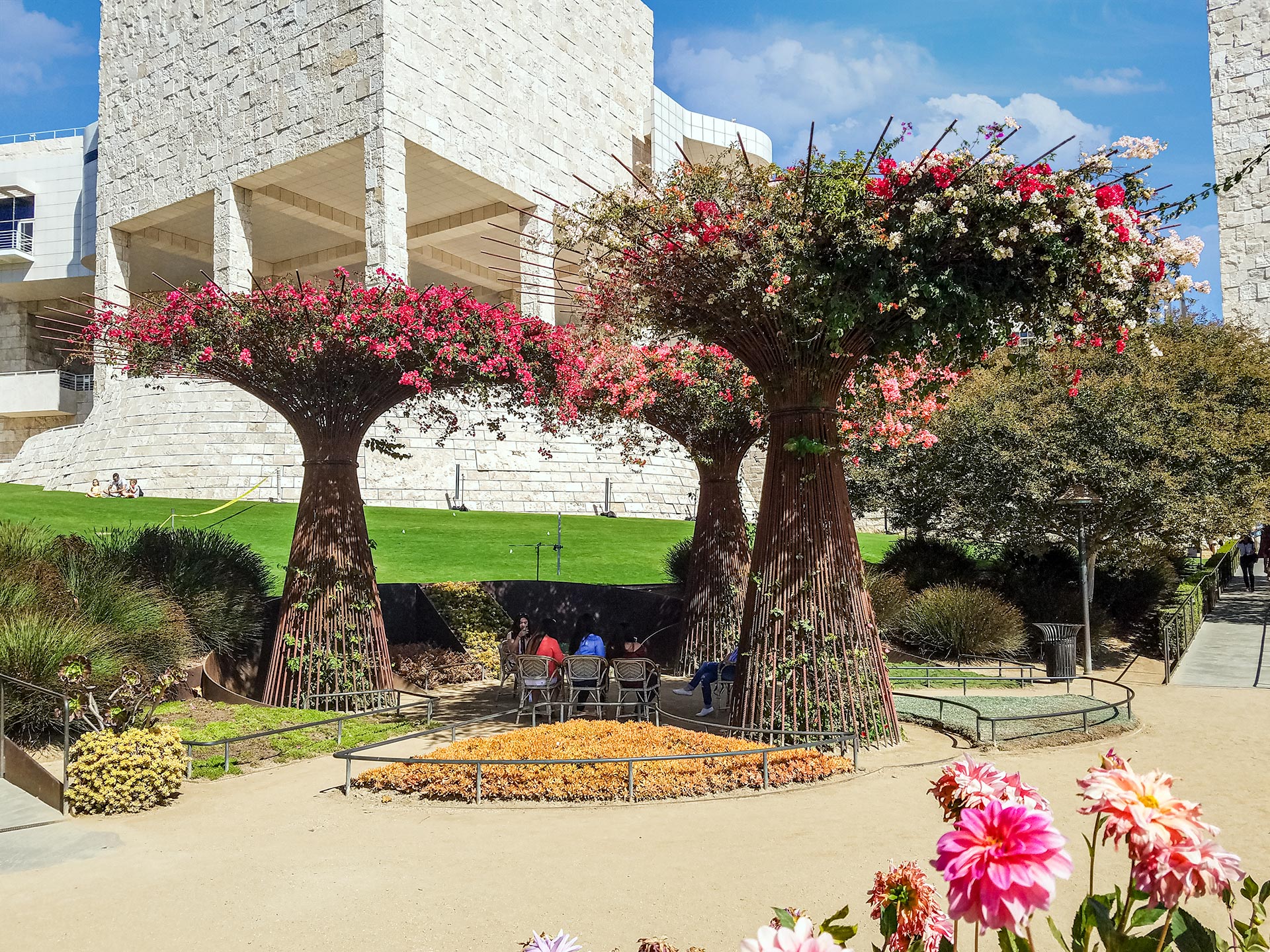
The Getty Museum
34° 4' 34.7844'' N 118° 28' 29.1972'' W
The Getty Center is renowned for its permanent collection, which includes pre-20th century European paintings, drawings, illuminated manuscripts, sculpture, and decorative arts; 19th and 20th century American, European and Asian photographs; and contemporary and modern sculpture.
With its fine art exhibitions, impressive architecture, lush gardens and spectacular city views, the Getty Center draws 1.8 million annual visitors for educational and recreational purposes alike. Whether you’re looking to reflect in the present or rethink history, you don’t have to travel far to enjoy these experiences. Read on for ten must-sees and hidden gems at the Getty Center and get ready for a feast for the senses.
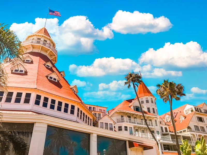
Hotel Del Coronado San Diego California
32°40'48.3"N 117°10'39.4"W
In 1958, Hotel del Coronado made Hollywood history when it became the setting for director Billy Wilder’s classic comedy, Some Like It Hot, starring Marilyn Monroe, Tony Curtis, and Jack Lemmon. Released in 1959, this romantic romp was voted the #1 comedy of all time by the American Film Institute and named #14 on its list of the 100 Greatest Movies. As film historian Laurence Maslon – who authored a companion book about the film – noted: With the addition of “the famously photogenic Del Coronado, it’s easy to see why this movie has stood the test of time.”
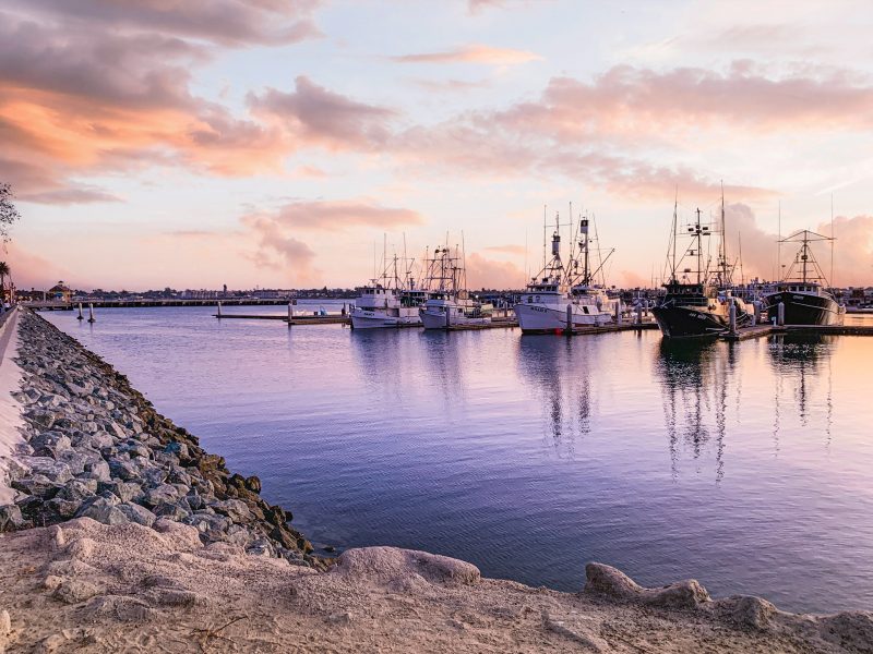
Tuna Harbor Park San Diego California
32°42'43.7"N 117°10'23.7"W
Named for the commercial fishing industry in San Diego and reflecting its history as a tuna port, this park provides visitors with shaded areas to relax, a scenic promenade for walking or jogging, bike routes and a perfect vantage point for viewing the diverse boating activity of San Diego Bay.


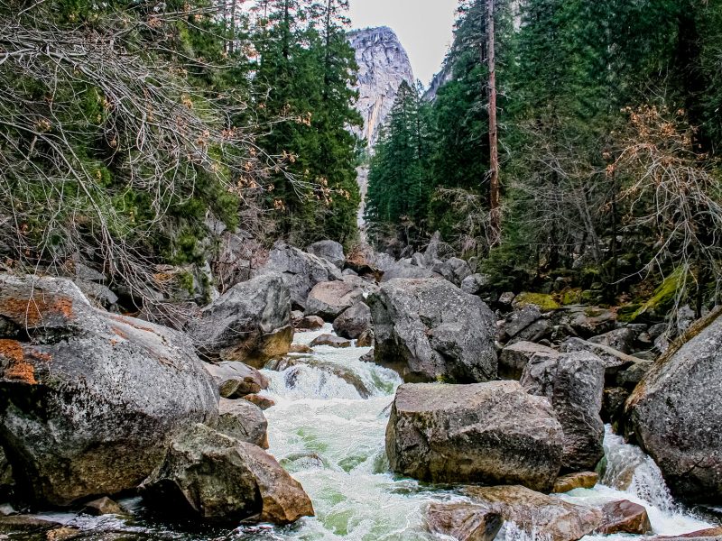
El Capitan Yosemite Park California
43.7350° N, 15.8952° E
El Capitan’s iconic granite walls dominate the west end of Yosemite Valley. At more than 3,000 feet (900+ m) above the valley floor, it is 2.5 times as tall as the Empire State Building, or more than 3 times as high as the tip of the Eiffel Tower. Coming around the corner and having El Capitan suddenly fill your field of vision sometimes moves people to tears. It is a beacon for visitors, a muse for photographers and one of the world’s ultimate challenges for climbers.
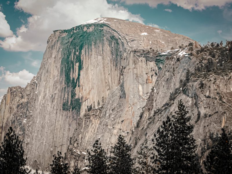
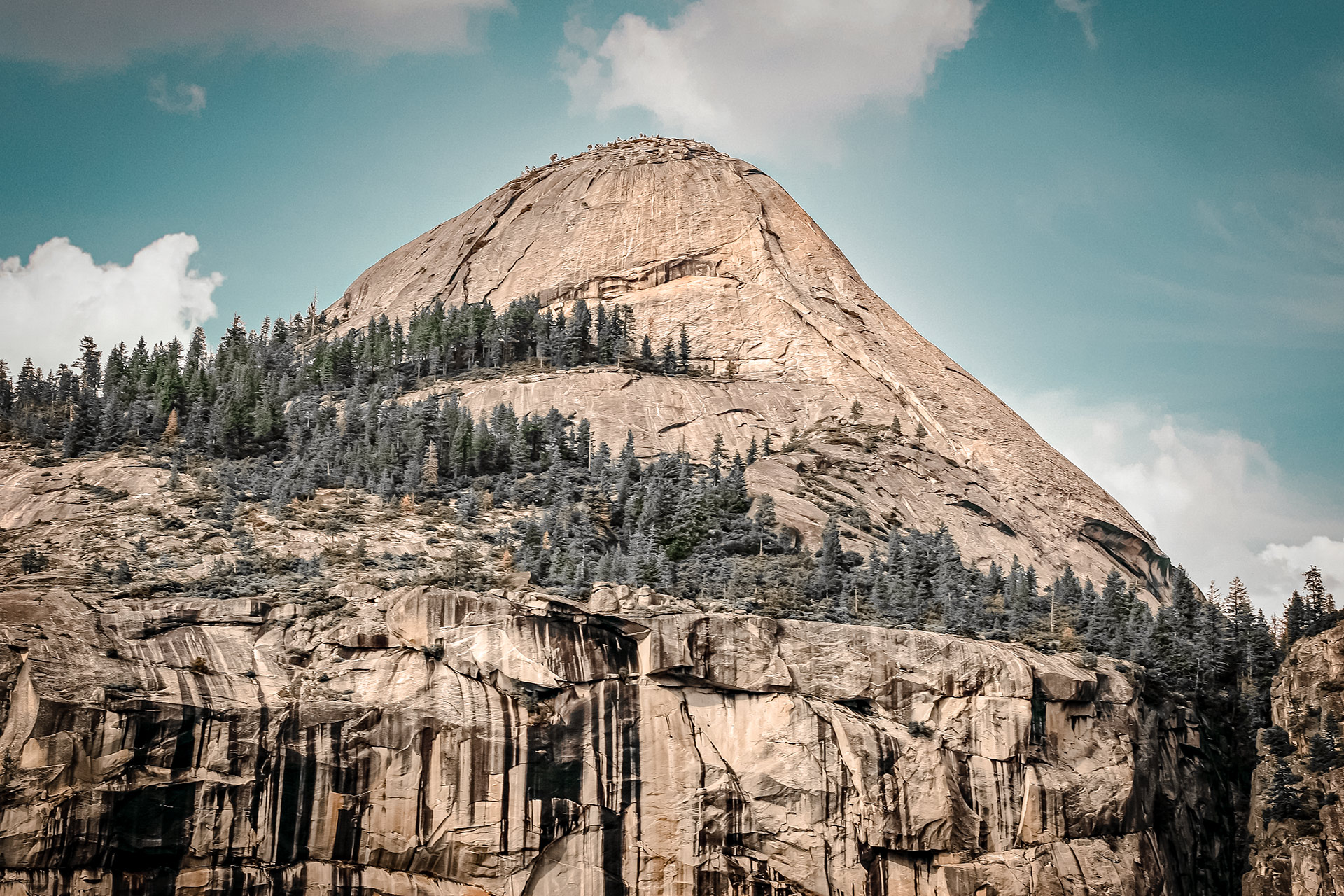
Half Dome Yosemite Park California
43°44'16.3"N 15°53'21.2"E
Half Dome is one of Yosemite’s most famous sites and particularly well-known in the climbing world for being one of the first “big climbs.” This granite icon looks much different depending on the angle you are viewing it from. Looking up at the sheer rock face from the valley, the enormity of the wall is obvious, and you can appreciate why climbers have been drawn here.
You can also see Half Dome in the distance from Tunnel View, but the best place to view it is from the lookout at Glacier Point. From here, you get a true picture of the rock, how it looms over the valley, and how much higher it stands than the surrounding mountains. The dome shape is clearly evident, and you can easily see why it’s called Half Dome.
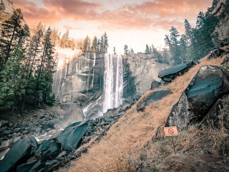
Vernal Falls Yosemite Park California
37°43'36.5"N 119°32'42.1"W
Vernal Fall is only 317 ft (96 m) tall but it is among the most powerful waterfalls in Yosemite. Unlike Yosemite Fall or Bridalveil Fall, Vernal cannot be viewed from the valley floor by car. To see it you must get on the trail. Luckily you have lots of options. The easiest path is along a well-marked path that begins near the Happy Isles Nature Center. You can a free shuttle bus to Happy Isles Nature Center or walk there from Curry Village. From there follow the trailhead to Vernal Fall footbridge (about 1 mile) or continue on to the top of the waterfall. This is a great option if you want to wander through the mist of this very powerful waterfall.
Vernal Falls Bridge Yosemite Park California
37°43'33.9"N 119°33'05.9"W
Los Angeles International Airport
The LAX airport, or the Los Angeles International Airport, was originally named Mines Field and was a general aviation base during World War II. LAX is located in none other than Los Angeles, California. It is ranked as the fifth busiest passenger airport in the entire world. It also is ranked sixth in the world in carrying cargo. Even if you never travel through LAX, (although chances are good that you will)
There are more than 50 million people who travel into or out of LAX every year. But, not only people travel through. An additional 2 million tons of cargo passes through this airport every year as well.